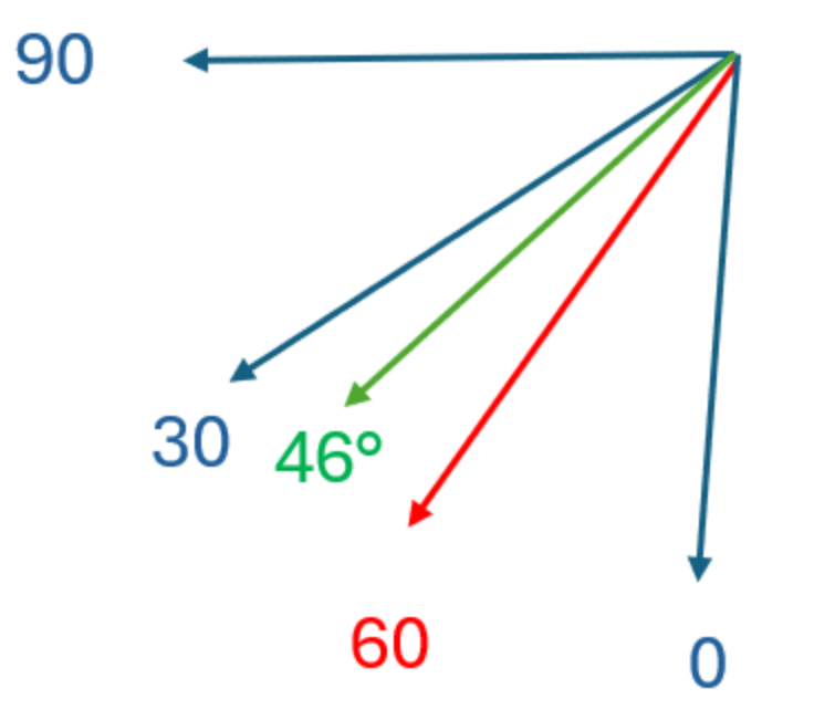
The sector interpolation problem is illustrated with figures belows.
This is a case where the sector interpolation works without issues:
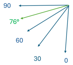
The blue arrows represent the wind field directions at the mast location (shown with their labels, aka "sect3"). You have measured wind direction 76 degrees at the mast. When we transfer the climatology to a new location, we can perform sector interpolation by looking at the relative wind speed and direction change between the mast and the new location in the wind field labeled "090" and in the wind field labeled "060". In simple terms, we then linearly interpolate those changes depending on the angle between the measured and simulated wind directions (really we use vector calculus, but this is almost the same) - if the "090" or "060" sector has a direction at the mast of exactly 76 degrees, it receives all the weight. If not, we use a linear combination.